New map shows 'worst case' impact climate change could have on UK
5 March 2021, 19:16 | Updated: 5 March 2021, 19:22
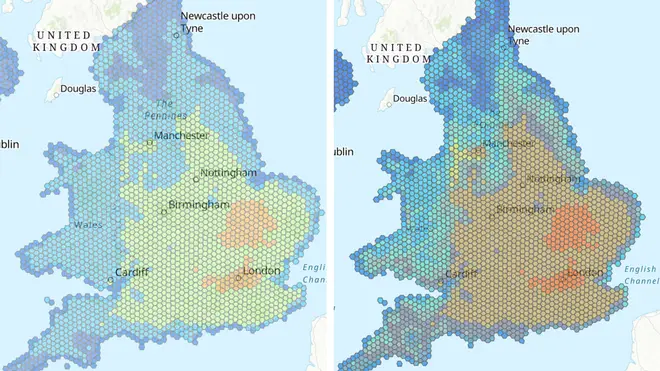


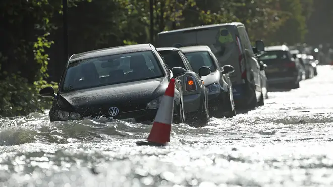
A new map showing the "worst-case scenario" effects climate change could have on the UK has warned of widespread overheating and frequent flooding.
The map, created by the National Trust, reveals that without a significant reduction in carbon emissions, the number of its sites under threat from climate impacts could more than treble from 3,371 (5%) to 11,462 (17%) over the next 40 years.
And the number of sites at high or medium risk of climate-related hazards could increase from 20,457, or 30% of sites, to 47,888, or 71%, by 2060.
The map shows how overheating and humidity will become a significant problem in large parts of the east and south of England - including London - with the issue spreading across much of the country by 2060.
Read more: Climate change 'threat to global peace and security', warns Boris Johnson
The map is based on a "worst-case scenario" where there is a failure to decrease emissions over the coming decades but is intended to be a flagging tool to highlight potential future hazards.
The Trust is working to pinpoint locations that need interventions, such as planting trees or restoring peat bogs to hold or slow the flow of water to prevent flooding, or more shade to protect areas at risk of high temperatures.
The charity is working in partnership with government bodies to plot all cultural heritage sites in the UK and has unveiled the map ahead of key UN climate talks in Glasgow to drive international action on climate change.
If talks are successful and promises acted on, the charity says, it would avoid the worst-case scenario in the map.
National Trust director for land and nature Harry Bowell said: "This map is a game-changer in how we face the threat climate change poses to the places we care for.
"While the data draws on a worst-case scenario, the map paints a stark picture of what we have to prepare for. But by acting now, and working with nature, we can adapt to many of these risks."
Read more: Young people could be 'champions of environmental change', says Prince William
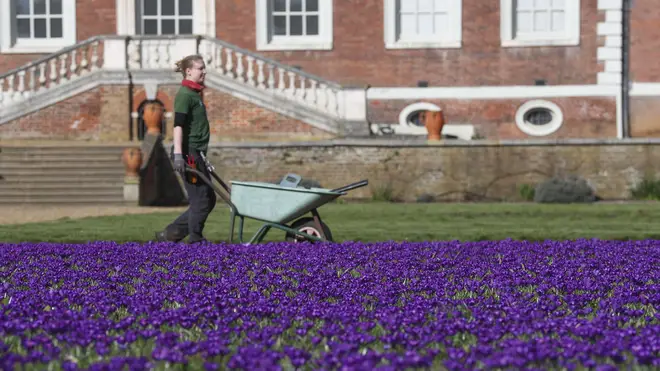
The Trust says staff are already taking action to cope with rising temperatures, such as at Ham House in London, which could often face 40C (104F) heat by 2040.
More heat-tolerant plants are already being grown and garden working hours have shifted to start and finish earlier to avoid summer afternoon heat.
At Mount Stewart, Northern Ireland, where rising sea levels in Strangford Lough have contributed to coastal erosion, the carpark has been relocated and a shelter-belt from incoming sea water created.
And at Malham Tarn, in the Yorkshire Dales, an otherwise sound 18th century barn collapsed due to soil shrinkage, but teams can now intervene with moves such as tree planting and using certain plants to manage the water table.
A 16th century listed farmhouse in Wales, Dyffryn Mymbyr in Snowdonia has been protected against the impact of increased driving heavy rainfall by installing "slate hanging" on the exposed end of the building.
The map plots the impacts of extreme heat and humidity, landslides, coastal erosion, shrinking and shifting ground due to wet and dry conditions known as "soil heave", and high winds, in 2020 and 2060.
It uses data from a number of sources and plots them in 5km hexagonal grids across England, Wales and Northern Ireland.
The National Trust is also sharing available data on flooding with staff on properties prone to flooding and action that can be taken, but the information is too localised to be included on the map.