UK weather: Britain braced for snow tomorrow as Arctic blast returns
3 February 2022, 15:20 | Updated: 3 February 2022, 15:47
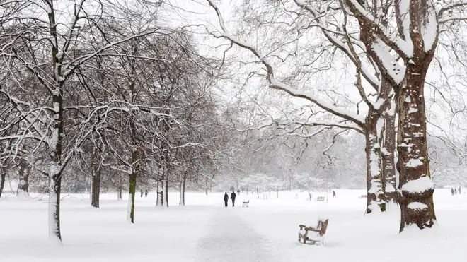


An Arctic blast and heavy snow could be seen as soon as Friday in some parts of the country, according to the Met Office.
Wintry, bitter winds and sub-zero temperatures are forecast in many parts of the UK this week, forecasters said.
Parts of Cumbria are set to see the heaviest snowfall in England, as well as some areas in Yorkshire and Manchester. Those in the north of Scotland will expectedly have the coldest weather in the coming week.
The Met Office says there could be a “big change” in the weather by the end of the week, with temperatures set to dramatically fall.
“Some of us may even see some snow by Friday”.
Forecaster Clare Nasir said the cold front will "sweep down towards the southeast in the early hours of Friday morning with wintry showers to follow and again the risk of snow."
There'll be a "cold and biting wind to the north as well as the east - icy conditions here, particularly later on as the temperatures tumble and also that feed of showers, again a mix of rain, sleet, hail and snow. Certainly snow over the higher ground".
Most of the UK has seen milder temperatures so far this year. But, colder Arctic floods are set to head southward - London is predicted to plummet by 4C, as wintry breezes hit the capital by the end of the week.
A yellow weather warning for ice has been issued in Scotland and Northern Ireland as the cold blast works its way down the country.
The update comes days after Storm Corrie and Storm Malik brought severe winds in many parts of the country.
Winds have gone up to 92mph and left 30,000 people without power in Scotland, as well as an extra 7,000 cut-off by Storm Malik.