Storm Dudley: Snow, ice and 90mph gusts to batter Britain this week, Met office warns
13 February 2022, 20:30 | Updated: 14 February 2022, 10:26
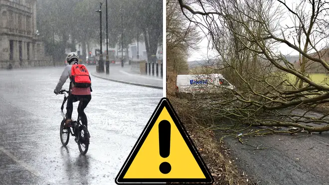


The UK is set to be battered by wintery weather this week as the Met Office warn of snow, ice and gusts of up to 90mph.
Listen to this article
Loading audio...
Residents in the north of England and Scotland have being told to brace themselves for high winds as the Met Office issued a yellow alert for wind on Wednesday and Thursday for parts of Northern Ireland, most of Scotland and the north of England.
Weather experts are predicting the entire country is set to for a blustery week, with Met Office meteorologist Tom Morgan warning that "this whole week is going to see quite a disturbed weather pattern developing across the UK".
Forecasters have predicted that the worst of the wind looks likely to hit midweek, with a 24-hour weather warning coming into force from 6pm on Wednesday, stretching down from the Orkney Islands to parts of Yorkshire and Lancashire, as a weather system moves in.
Read more: Patient helpline opens after hospital doctor arrested on suspicion of sexual assault
Read more: 'Don't fear Putin': Former Ukraine PM's message to West as Russia invasion 'highly likely'
Becoming very unsettled next week with #rain and #gales likely for many of us, all thanks to a powerful #jetstream fuelling rapidly deepening areas of low pressure🌧️🌬️
— Met Office (@metoffice) February 13, 2022
Check out the detail in our forecast👇 pic.twitter.com/hZhyfT42ET
"That's likely to bring some severe gales and possibly storm force winds to parts of this region. Western parts of Scotland look like bearing the brunt of the strongest winds, where we could see gusts of 80mph to 90mph on Wednesday night and Thursday morning," Mr Morgan said.
"That's strong enough to bring some quite widespread disruption, and it's an area of the country that's seen several named storms this winter season already."
The meteorologist added that there was a possibility this could become a named storm itself, and closer to the time the warnings issued may need to be escalated.
As part of the yellow wind warning, the forecaster said there was the potential of inland gusts of up to between 60mph and 70mph, with exposed coasts and hills seeing speeds reaching 90mph.
"It's not just going to be strong winds this week," said Mr Morgan, who warned there could be snow in Scotland, Northern Ireland and northern England, adding there was likely to be snow and ice warnings issued over the next few days. And the bad wintery weather was not just for the northern parts of the UK.
"The southern parts of England and Wales will see their turn. It looks very, very windy in the south at this stage for Friday," he said.
"There could be some quite widespread travel disruption in parts of the UK through this week."
Read more: Energy supplier mistakenly sent man £2trillion cheque for Storm Arwen damages
Read more: Europe 'may be on the verge of war': Germany's vice chancellor on Ukraine

Storm Barra hits UK and Ireland
He added: "All parts of the UK will see some very strong winds at times.
"It's Scotland and the North's turn on Wednesday and into Thursday, and then it's probably going to be the southern parts of England and Wales that will see the very strongest winds on Friday."
Experts say the change in weather is due to an "active jet stream" which will drive a series of low-pressure systems across the country.
The Met office said the changes in the weather "will be closely watched" adding there is the potential for further National Severe Weather Warnings to be issued for wind and rain as the week develops.
Read more: Kurt Zouma withdrawn from West Ham starting line-up after 'injury' following cat kicking video
Read more: 13 people injured after mezzanine floor collapses in London bar
The official forecast reads:" Rain or showers and very strong winds at times, especially in the north. Mild in the south, but occasionally colder in the north with some wintry showers.
"Looking to become increasingly unsettled through the start of this period, feeling cold with sunny spells and wintry showers to the north, while central and southern areas are expected to be cloudier with some rain, potentially heavy.
"Perhaps some disruptive winds accompanied by rain and short lived snow by the end of the week.
"Remaining changeable into the following week, in addition to possible spells of rain, some wintry, to the north, there is potential for heavy rainfall to the west and northwest.
"Strong winds likely to continue with a risk of gales across these areas, with severe gales along coastal regions.
"Temperatures generally around average, perhaps coldest to the north where some short lived cold spells could bring some brief periods of snow."