Heavy rain and snow to hit parts of UK for bank holiday as Met Office warns of disruption
2 January 2022, 23:20


Heavy rain and snow are expected to hit parts of the UK for Bank Holiday Monday, the Met Office has said.
Listen to this article
Loading audio...
Forecasters predicted that "hill snow" and "wintry showers" will be on the way for the north during the day, with sunny intervals also expected.
In the south, "sunshine and showers is the order of the day", the Met Office said.
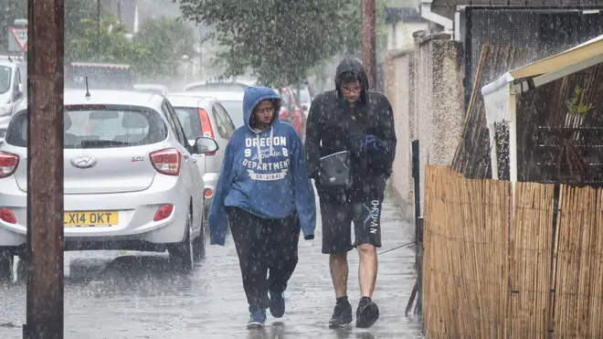
It comes after strong winds and heavy downpours began on Sunday evening, following warnings of thunderstorms from the agency.
It said the extreme conditions could result in sudden flooding, lightning strikes and possible "localised disruption" to areas including the east of England, London and the south-east, south-west England and parts of Wales.
Read more: Tories pressure Boris Johnson to scrap taxes on rocketing energy bills
Read more: No need for more Covid restrictions, Cabinet minister says
Sunshine and blustery showers features in Monday's #4cast, however a change is under way as a band of cloud and rain edges south introducing #cold #Arctic air 🌡️📉 Showers falling increasingly as snow across the hills and mountains of the north during the day🌦️❄️🗻 pic.twitter.com/UaEUuLhGe0
— Met Office (@metoffice) January 2, 2022
Parts of the South West were also included in the warning, with the chance of power cuts as well as public transport delays or cancellations.
The weather's turn for the worst came after temperatures reached as high as 16.3C in St James's Park in central London on Saturday – provisionally making it the warmest New Year’s Day on record in the UK.
However, there is little sign of a return to warmth in coming days, with the Met Office also issuing yellow warnings for wind and snow in Scotland for Tuesday and Wednesday.
Read more: Huge fire breaks out at South African parliament in Cape Town
What will the #weather have in store for the first week of 2022?
— Met Office (@metoffice) January 2, 2022
Here is the latest forecast...👇 pic.twitter.com/R1YUupkgut
Met Office forecaster Simon Partridge said: "The combination of gales and snow showers is why there is a warning out for that part of the world.
"Driving conditions will be really dangerous because you are not going to see a great deal if you have got gales and snow."
Angus, Grampian, Highlands and Eilean Siar, plus Orkney and Shetland are among the areas that could be affected.
Areas above 200 metres could be among the worst affected, with the snowfall possibly reaching 10-15cm in places.
The weather warning adds: "In combination with winds gusting 50 to 60mph, perhaps 70mph on exposed summits, temporary blizzard conditions and some drifting of snow on higher-level routes is likely.
"Gusts of around 70mph on exposed coasts will generate some large waves and dangerous coastal conditions in a few places."