UK weather: 66 flood warnings in place as 'chaos could continue until Tuesday'
17 November 2019, 08:37
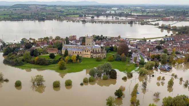


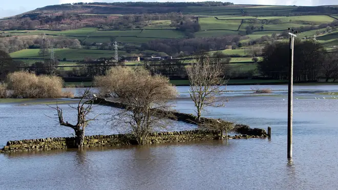
Swathes of the country remain underwater as experts warn the flood chaos could continue until Tuesday.
66 flood warnings and 96 flood alerts remained in place on Sunday morning, meaning flooding is expected and immediate action is required.
The rivers Severn and Avon have burst their banks leaving properties waterlogged in Gloucestershire and Worcestershire, while residents in the Midlands and Yorkshire are still battling to clear their homes.
But despite some areas enduring their "wettest ever autumns", much-needed relief from heavy rainfall has been forecast for flood-hit areas in the coming days.
Meteorologist Sophie Yeomans said: "There is some rainfall around, but it's looking light and patchy.
"Sunday has the highest risk of rainfall, but the start of next week is looking quite dry.
"There's light cloud and rain around in some of the areas in the north of England and also down in Shropshire and the West Midlands.
"But there's no long-lasting or heavy rain - it's a good situation."
In a forecast of the flooding risk in England and Wales, the Environment Agency said: "River flooding is expected to continue in the Lower River Don washlands area in South Yorkshire through to at least Tuesday, where properties will continue to flood and there will be continued travel disruption."
Here's the 4-cast for Sunday:
— Met Office (@metoffice) November 16, 2019
💧 Some patchy rain still around
☁️ Cloud lingering across northern England and Wales
🌬️ Breezy along the coasts
🥶 Another chilly day pic.twitter.com/WAHgOpJyRv
Communities in parts of central and northern England continued the clean-up after being overwhelmed with water following torrential rain in recent days.
The EA for Yorkshire and the North East said there is still lots of flood water in the region, and a pumping operation is under way to reduce water levels.
In an online message, Martin Christmas of the EA, said: "We are starting to think about moving from emergency rescue response into recovery and that means looking at our flood warnings and then starting to think about all the inspections we need to do to look at potential repairs for banks and flood assets based on the loading they have received from the water in the last week.
"We have still got tens of people out there in the field carrying on with pumping activity trying to get levels at Fishlake reduced and we are also keeping an eye on East Yorkshire as well."
The Met Office said its Sheffield weather station has recorded its wettest ever autumn.
It tweeted: "With 15 days still to go, the site has already recorded 427.6 mm of #rain. The previous record was set in 2000 with 425.2 mm of rain falling between September 1 and November 30 that year."
There is also a "risk of seeing a very cold start" on Tuesday, according to Ms Yeomans, with potential temperatures of minus 5C.