
Exact areas snow could fall this week as Brits told to prepare for up to six-inches while others face torrential rain
26 February 2024, 20:30 | Updated: 27 February 2024, 00:48
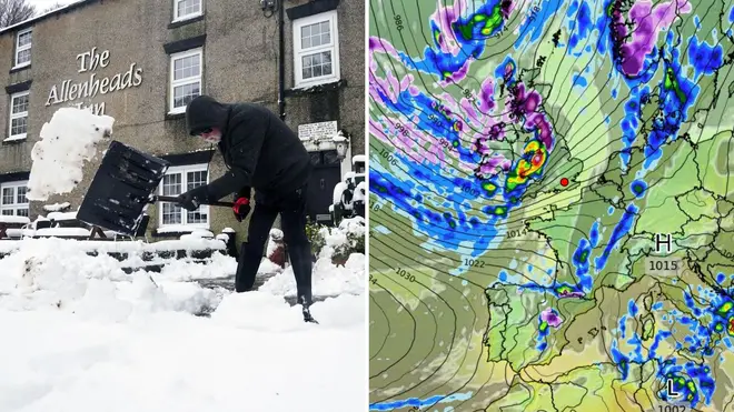


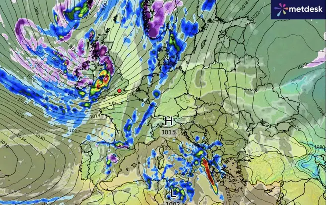
Brits have been warned to prepare for heavy snowfall later this week - with some areas forecast to face up to six inches.
Listen to this article
Loading audio...
Parts of England, Scotland, and Northern Ireland could all face snow by Friday, according to forecasts from WX Charts.
The blast of snow is due to "blocked" air currents from Iceland and Greenland, the Met Office explained
Northern Ireland is set to be hit by snow first as the currents make their way from the north. The blast will then reach parts of western Scotland and then England, as far as Manchester.
For those not facing snow this week, many will instead battle a wet and windy period adding to last week's constant torrential downpours.
The cold temperatures will then continue into mid-March following the hottest British Februarys on record.

Read More: Fears of travel chaos on Sunday and Monday amid heavy rain, as yellow weather warning issued
Read More: Heavy downpours to sweep UK as new weather maps show incoming wall of rain
"Towards mid-March there is an increased chance of a greater likelihood of higher pressure as a ‘blocked’ pattern becoming established over Greenland and Iceland, with lower pressure towards the south and southwest," the Met Office told The Express.
"This is likely to bring a trend towards increasingly settled conditions, with the likelihood of drier than normal conditions, especially in the north. This may lead to a slightly greater than normal chance of colder than average temperatures, although this is mitigated as we move further into spring."
The Met Office's long-term forecast for northern regions in March warns of "snow accumulations" in some areas.
"There will be drier interludes between times though, with some pleasant spring sunshine, especially in places sheltered from the often strong winds," the forecast for between March 1 and 10 says.
"The following week is likely to remain fairly mixed overall, but there may be a greater incidence of dry spells and early spring sunshine, especially in eastern areas. Temperatures are likely to be fairly typical, with a few overnight frosts still likely."


