Fresh warnings for flash floods and heavy rain after days of thunderstorms
17 August 2020, 12:05


Thunderstorms and torrential downpours are coming for large pars of the UK with warnings of potential floods for some areas.
Weather across the country has been unsettled since the UK basked in a six-day heatwave which saw temperatures top 30C for a sustained period.
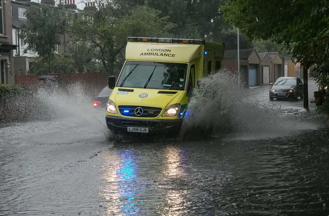
But now forecasters are warning of potential heavy rain following a weekend which saw flash flooding across some parts of southern England.
A yellow thunderstorm warning covering the whole of Wales, southern England and parts of the north is due to expire at 9pm on Monday.
The Met Office has said he UK could see up to 1.6in (40mm) falling within in an hour in some areas
"If you're caught by a thunderstorm, you're likely to see 20mm-40mm (0.8in-1.6in) of rain within the hour, and some areas could see 50mm-70mm (2in-2.8in) within three to four hours," according to Nicola Maxey, a spokeswoman for the Met Office.
"Really, anywhere within the warning area is at risk of those storms."
The Environment Agency has issued a number of flood alerts for parts of the Midlands around Birmingham.
Neil Davies, Flood Duty Manager at the Environment Agency, said: “Isolated thunderstorms could bring sudden surface-water and river flooding, which may lead to flooded properties and severe travel disruption in some areas.
“Further surface water and river flooding is also a possibility until Sunday.
“Environment Agency teams are working hard alongside local authorities to reduce the risk of flooding and keep communities safe, clearing grills and weed screens in areas which may be affected by heavy showers, and are ready to respond and support where needed.”
Surface water #flooding is possible across parts of England and Wales today as heavy showers and #thunderstorms continue.
— Environment Agency (@EnvAgency) August 17, 2020
Stay #FloodAware and check your flood risk here: https://t.co/BpUpnj1mdd pic.twitter.com/TYYpcRyASK
It comes after visitors were told to avoid Sheringham beach in Norfolk after storm water began overflowing on to the beach on Sunday.
"We are aware of storm water overflow on the beach in Sheringham and are working with Anglian Water and RNLI Lifeguards," North Norfolk District Council tweeted.
"We ask that you avoid accessing the beach in the area at this time."
Roads were closed in the area due to bad weather, while Norfolk Police warned of "very poor" driving conditions on the A11 on Sunday evening due to flooding and heavy rain.
Amid unsettled conditions, a huge funnel cloud appeared over the Bristol Channel, which appeared to create a spray from the sea and was visible for around 15 minutes, according to onlookers.
The M11 northbound was forced to close between Junction 7 and Junction 8 at Stansted due to severe flooding.
Elsewhere, Northamptonshire Fire and Rescue Service said on Twitter that it had removed approximately 8,000 litres of flood water from the basement of Wellingborough Museum.
Following a series of weather warnings for parts of the UK, a yellow thunderstorm warning has been issued covering a large area of Scotland for Tuesday afternoon.
Heavy showers could lead to properties being flooded, while there is a chance roads could be closed due to rain lashing the area, the Met Office said.
Sunshine and showers are expected across the UK during the week but rainfall will be more sustained, with the potential for 0.8in (20mm) falling over six hours.
⚠️ Yellow Rain Warning issued ⚠️
— Met Office (@metoffice) August 17, 2020
Tuesday 1300 – 2100
Heavy showers in Scotland could give difficult travelling conditions and localised flooding
Latest info 👉 https://t.co/QwDLMfRBfs
Stay #WeatherAware 💧 pic.twitter.com/3JZAVVcCP3
Temperatures are closer to average compared with last week's scorching conditions, with south-east England "significantly cooler" with highs of up to 25C (77F) on Monday, according the Met Office's Ms Maxey.
"As we go through the week, we're looking at those mid-20s for the south-east and, as we go further north, towards Manchester, it will be 22C, 23C, so the low 20s the further north you go," she said.
"This is closer to average as we're heading towards autumn, so not that unusual."