
Weather warning: Brutal storm to batter UK with 80mph winds this weekend
23 November 2021, 14:12 | Updated: 23 November 2021, 15:11
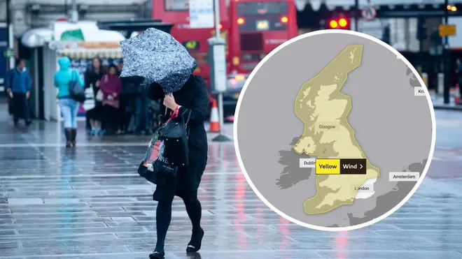


A brutal storm is set to batter the UK this weekend, with forecasters warning of 80mph winds and widespread disruption to travel.
Listen to this article
Loading audio...
The Met Office has issued a yellow weather warning for "strong winds" across most of the UK on Saturday, from the early hours through to 6pm.
Forecasters have warned Brits to brace themselves for wind speeds of up to 80mph along some parts of the coast on Saturday, with delays to road, rail, air and ferry transport expected.
Gusts will widely reach 50mph to 60mph for most of the country.
Scotland will be the first to see the very strong winds as they approach from noon on Friday, with the weather front gradually making its way further south and becoming more widespread overnight and into Saturday morning.
The Met Office said winds will tend to slowly ease from the north during the afternoon.
They warned of possible damage to buildings, such as tiles being blown from roofs.
Bridges and roads could also close and the Met Office said there is a slight chance power cuts may occur, affecting services such as mobile phone coverage.
Read more: Winter warning: Be ready to pack medicine if you're at risk of flooding, expert says
Read more: Brits set to shiver with snow and '-4C Arctic blast' to sweep across UK
⚠️ Yellow weather warning issued ⚠️
— Met Office (@metoffice) November 23, 2021
Strong winds across most of the UK
Saturday 0000 – 1800
Latest info 👉 https://t.co/QwDLMfRBfs
Stay #WeatherAware⚠️ pic.twitter.com/F881KD9FRR
Forecasters have also predicted that some regions could see snow before the end of next week, as most regions struggle to stay above freezing.
A 10-day chill is set to sweep through the country from Tuesday, with the north hit hardest as "heavy and wintry showers" will fall.
Forecasters at WX Charts predicted a 70% chance of the white stuff in Birmingham by the weekend.
Parts of the West Midlands could be hit by up to six centimetres of snow, forecasters said.
Those in the north, including Manchester and York, can also expect to see snow by the end of next week.
Read more: Climate crisis: Human-caused damage could be irreversible for centuries - UN report
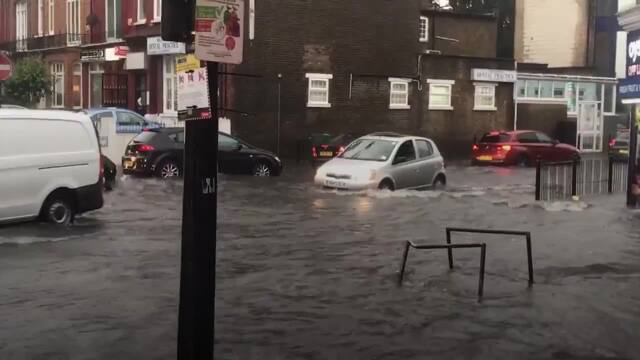
Flash floods across London cause travel chaos
Experts have also warned of a higher chance of a wetter than normal winter over the November-to-January period.
The UK should be braced for flooding and at-risk households need to get ready to pack medicines and important documents, experts said.
The Met Office's head of civil contingencies, Will Lang, said weather patterns suggested milder, wetter and sometimes windier conditions could be on the way during winter.
A milder than normal winter would match up with the warmer winters caused by climate change.
But Mr Lang warned: "Cold weather spells and impacts such as snow do remain possible, and these cold weather impacts are more likely during the first half of the period, up until Christmas.
"There is a higher chance overall than normal of wet conditions, and also that implies that there is a higher likelihood of impacts from rainfall and indeed from winds, especially later in the period, January and beyond that.”


