Flash floods break out in London amid amber warning of flooding, power cuts and lightning strikes
17 August 2022, 10:17 | Updated: 17 August 2022, 15:52
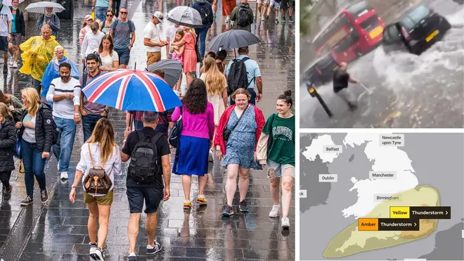


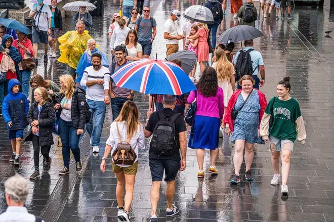
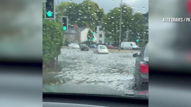
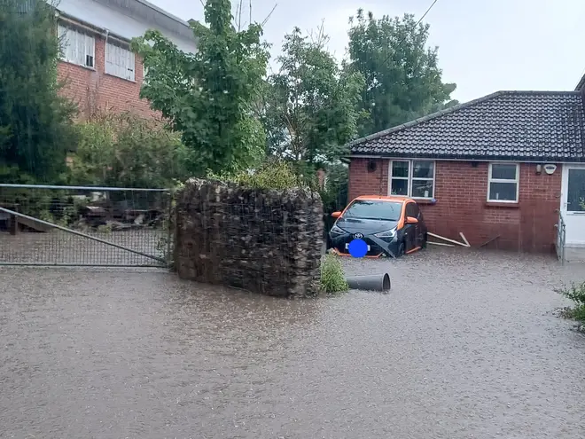
Flash floods have broken out across London after a torrential downpour in the capital.
Listen to this article
Loading audio...
It comes amid an amber weather warning for thunderstorms has been issued for a large part of London and southeast England.
Victoria and Kentish Town stations are among those known to be affected, with streets outside King's Cross covered with water after a heavy shower on Wednesday afternoon.

Flash flood seen as London weathers thunderstorm after heatwave
The country is set to be battered by storms after a sweltering week of sunshine.
A yellow warning was already in place for the majority of England, but now some areas have been updated to amber.
A swathe of England from Chichester to Ipswich, including London and all of Kent, has been warned flooding of homes and businesses is "likely and could happen quickly".
Read more: Tornado over Cornwall as huge mudslides and torrential downpours hit UK
Read more: 'Pack an emergency bag': Brits warned to prepare for flash floods as thunderstorms set to batter UK
The Met Office warning means "fast flowing or deep floodwater is likely" and will "probably" lead to difficult driving conditions and road closures.
The forecaster also warns power cuts are "likely" in some areas and buildings could be damaged by lightning strikes.
The warning comes into force at 11am and remains in place until 10pm tonight.
⚠️⚠️ Amber weather warning issued ⚠️⚠️
— Met Office (@metoffice) August 17, 2022
Thunderstorms across parts of southeast England
Wednesday 1100 – 2200
Latest info 👉 https://t.co/QwDLMfRBfs pic.twitter.com/Xg5JSF5j6H
Weeks of sweltering weather in the UK has caused drought and left land parched, meaning heavy rainfall is not absorbed by the ground and so can quickly lead to flooding.
The Met Office said earlier "20-30 mm of rain is possible within an hour" on Wednesday.
"Whilst some places will miss them, thunderstorms and areas of heavy rain will develop quite widely on Wednesday across central, southern and eastern parts of England and southeast Wales," the forecaster said.
"20-30 mm of rain is possible within an hour, but where areas of thundery rain become slow-moving, some places could see 60 mm in less than three hours.
"A few spots could see more rainfall than this still, whilst hail and lightning may be additional hazards."
Truro in Cornwall flooded as heavy rain follows heatwave
The Environment Agency had issued 29 flood alerts by Tuesday night.
The heaviest downpours on Tuesday were at Spadeadam in Cumbria, with 25.4mm of rain, and in Trengwainton House, Cornwall, with 18.4mm, the Met Office said.
It came as authorities moved Yorkshire to official drought status on Tuesday, following parts of the South West, southern and central England and the East of England.
A hosepipe ban will also be introduced for 15 million Thames Water customers in London and the Thames Valley from August 24.
Read more: Thames Water imposes hosepipe ban on 15 million customers
Read more: 'Thunder fever' to strike again: Warning as heavy rain expected to trigger rare weather phenomenon
Footage and photos shared to social media on Tuesday showed torrential rain and floodwater sweeping through towns across southern England and Wales, including Newquay in Cornwall, Bishop's Tawton in Devon, Haywards Heath in West Sussex, Port Talbot in south-west Wales, and Bridport in Dorset.
One Twitter user shared a video of floodwater in Newquay, writing: "I've never seen rain like this. Our road is flooding #Newquay."
Another Twitter user in Bishop's Tawton, north Devon, said: "(F)lash flooding causing use of sandbags to prevent water in house, despite recent flood work by @EnvAgency urgent need for solutions."
ScotRail imposed speed restrictions on some routes on Tuesday, while in Perth, Network Rail said it dealt with flooding at the station.

Waterspout seen in the cloudy skies over Cornwall
Wednesday is the fourth day in a row of thunderstorm warnings in the UK and it leaves communities in areas like Sussex, Kent and Hampshire braced for possible heavy downpours.
Met Office forecaster Simon Partridge said that "heavy thundery showers could develop in warm muggy air" and "there could be some high totals (of rainfall), particularly if you see some heavy thunderstorms come in one after another".
People in northern regions should be able to enjoy a day that feels fresher, a little cooler and is mostly dry - with some sunny spells.
Mr Partridge said: "The ground has been so baked dry because of the heat and the lack of rain for a number of days.
"When the rain has come, it has been hitting ground that is completely dry and baked dry like concrete... if there is some moisture in the ground, it is a lot easier for it to soak up the rain that hits it.
Read more: Firefighters find unexploded WW2 bomb whilst tackling huge blaze sparked by disposable BBQ
"We have probably a higher run-off rate for the rainfall than we would normally have.
"It is almost like all the fields have been tarmacked because the water has been running off them as there has been so little of it that has gone into the ground."