Britain to be battered by snow blizzard and 60mph winds as Met Office warns of ‘treacherous conditions’
9 March 2023, 00:27 | Updated: 10 March 2023, 00:07


Britons are being warned that heavy snow could last for several days as amber weather warnings for parts of the UK come into effect.
Listen to this article
Loading audio...
The Met Office has issued three amber warnings for northern England, the Midlands, North Wales and Northern Ireland, where "significant disruption" to transport and power supplies is expected.
An amber warning means that there is a "potential risk to life".
Three yellow warnings for snow also cover much of the rest of the nation, with the exception of southern England and western Scotland.
Met Office meteorologist Jonathan Vautrey said the storm, which has been named by the French weather service, is bringing rain and snow to the UK.
"Storm Larisa, which Meteo France have named, is the same low pressure system that is bringing us the bands of rain," he said.
"But essentially, we're on the northern side of the low pressure system and it's the southern side of that low pressure system that is going to be bringing particularly strong winds to parts of France.
"So that did originate out in the Atlantic and then it tracked its way eastward towards us, and the weather fronts that are swirling around that low pressure system have then been pushing into the cold air that has been in places across the UK and allowing that rain to start falling as snow across several areas."


Forecasters warned that the heavy snow could cause "significant disruption" to transport links, cutting off some rural communities.
Meanwhile travel delays are expected on some roads, while power cuts are likely. Mobile phone coverage could also be affected.
It comes after Bristol Airport cancelled 27 morning flights on Tuesday and closed its doors for "snow clearing operations". Passengers at some other airports in the south of England have also been left waiting amid delayed departures.
Tuesday night was the coldest night since 2010, the Met Office said, with an Arctic blast causing the deep freeze.
And forecasters said that the ongoing cold weather and strong winds have "the potential to lead to some blizzard conditions" on Thursday.
Read more: Schools shut as snow blasts Britain: Is your child's school closed? Check the full list here
⚠️⚠️ Amber weather warning issued ⚠️⚠️
— Met Office (@metoffice) March 8, 2023
Snow across parts of northern England.
Thursday 1500 – Friday 1200
Latest info 👉 https://t.co/QwDLMfRBfs
Stay #WeatherAware ⚠️ " pic.twitter.com/2VLZHLUvwf
Motorists were told to plan ahead on Wednesday as heavy snowfall caused roads in Surrey and Hampshire to shut, with the downpour hitting much of southern England overnight and in the morning.
National Highways also warned drivers in the West Midlands and eastern England not to travel unless they absolutely have to, and issued a "severe" warning for drivers across the south-east and south-west.
The Met Office also warned of possible travel delays to bus and train services, and said some rural communities could become temporarily cut off.

Network Rail has told passengers to check their journeys before they set off because of the weather, but a spokesperson said there has been "no significant weather-related disruption" on the lines so far.
At least 27 flights due to take off from Bristol Airport on Wednesday morning were affected by snow, and several arrivals have been diverted to Birmingham. The airport reopened at 10.45 this morning staff said there was "ongoing flight disruption".
A spokesperson for the airport said "additional staff are on site to assist with the adverse weather response" and passengers have been advised to check with their airline prior to arriving at the airport.

It came as snow fell in London, the west of England and south Wales early on Wednesday, as Kinbrace in the Highlands saw -15.2C temperatures.
Schools closed across the South East and South West of England, as well as Scotland and parts of Wales.
A yellow warning for snow and ice was in place for most of southern England and southern Wales, lasting until 7am on Thursday.
Snow and ice warnings for Wednesday also cover northern Scotland until 10am on Thursday, as well as a third warning for snow and ice covering north-east England and south-east Scotland from 5pm on Wednesday to 7am on Thursday.
In most places the snowfall will continue until Friday, with a yellow warning for snow covering all of the UK north of Birmingham spanning from 7am on Thursday until 2pm on Friday.
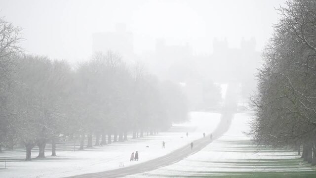
Snow falls over Windsor Castle
"Spells of snow on Wednesday may cause travel disruption during Wednesday into Thursday morning," the Met Office warned.
"Possible travel delays on roads stranding some vehicles and passengers. Bus and train services may be delayed or cancelled, with some road closures and longer journey times possible.
"Some rural communities could become temporarily cut off. Power cuts may occur and other services may be temporarily affected.
Met Office spokesperson Nicola Maxey said the minus 15.4C temperature recorded on Tuesday night meant it was the coldest in March since 2010.

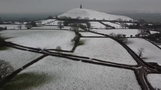
Drone footage of Glastonbury Tor as snow hits parts of the UK
Ms Maxey said an "Arctic maritime air" drifting over the UK from the north is causing the widespread snowfall and it could generate "blizzard conditions" on Thursday.
"We're going to see a cold night again tonight, especially in Scotland," she said.
"That Arctic maritime air will cross large swathes of the country on Thursday. There's also some strong winds around tomorrow, so that has the potential to lead to some blizzard conditions and drifting of lying snow."
Ms Maxey said average snow levels of 2-5cm are expected across much of the UK on Thursday, including in major northern cities like Manchester, Liverpool and Newcastle.
Up to 15cm (just under 6in) of snow is predicted to fall across higher ground in northern England, with "in excess of 25cm (just under 10in)" likely in the Scottish Highlands.
Temperatures could plummet to minus 3C in London on Wednesday night, and minus 5C in Edinburgh.
The lowest predicted temperature of minus 12C is expected to be felt in Aviemore in the Highlands.

"Untreated pavements and cycle paths might be impassable with a chance of injuries from slips and falls on snow-covered or icy surfaces."
A snow and ice warning was also in place for much of north eastern England and north and eastern Scotland until 10am on Wednesday, and one was in place for Northern Ireland until 9am.
Read more: Emergency coal-fired power stations to be used to avoid blackouts on coldest night of the year

Road delays
National Highways warned of long delays, especially during the evening rush hour.
Its severe weather alert was issued for South East and South West England and it takes effect from midday.
"Road users are advised to check ahead and plan for disruption to their journeys," it said.
"Snow is forecast to move north into the South West and the South East tonight. Snow amounts are expected to be small but could be widespread away from immediate coastal areas, with 1-2 cm for many and up to 2-5 cm on any modest hills (Haldon hill in particular).
"The snow is expected to ease during the morning but will be followed by a more significant second wave during Wednesday afternoon and through the evening.
"The snow will most likely lose ground in Devon but elsewhere it will be prolonged and occasionally heavy, particularly during the evening rush and to the east of the M5, leading to potential slow traffic and loss of traction on steep inclines (including the A417)."
Hampshire Police said asked motorists to "avoid travelling if you can", while Wiltshire Police said driving conditions are very dangerous and they have been responding to stranded vehicles and crashes.
Several lorries became stranded on the A39 at Nether Stowey in Somerset, forcing that section to shut.
On the South Coast, some roads have become impassable, including the A267 from Mark Cross to Frant and the A285 from Upwaltham to Heath End.
The A3, heading south from the A283 Milford to the Hindhead, has been closed.

Public transport
Bus services in Bath and Somerset have been suspended.
Rail services run by Southeastern face becoming disrupted from 5pm and some routes could shut early. The operator asked passengers to consider travelling home earlier than usual.
National Rail said: "The poor weather may cause disruption to train services, so please check your complete journey is possible before you travel."
Minor delays were reported on the District Line due to ice on the tracks.
The National Grid implemented emergency plans to avoid blackouts, with two coal powered stations in Lincolnshire feeding into the national grid on Tuesday ahead of what could have been the coldest night of the year.
The Met Office said it could drop to -15C in the Scottish glens.
Forecasters said on Tuesday morning that the south of England and Wales could be hit with 1-3cm of snow throughout, with local patches of snow reaching 5-10cm deep.
The cold weather is being driven by the same phenomenon linked to the Beast from the East in 2018.
The UK Health Security Agency asked people to check on vulnerable people during the spell.
Dr Agostinho Sousa, the agency's head of extreme events and health protection, said: "During periods like this, it is important to check in on family, friends and relatives who may be more vulnerable to the cold weather, as it can have a serious impact on health.
"If you have a pre-existing medical condition or are over the age of 65, it is important to try and heat your home to at least 18°C if you can."