Met Office wind warnings set to dampen hopes of a reprieve from blustery British weather in August
3 August 2023, 17:36 | Updated: 3 August 2023, 17:39
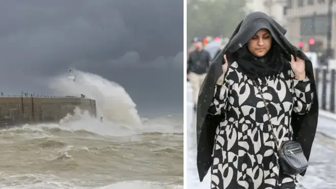


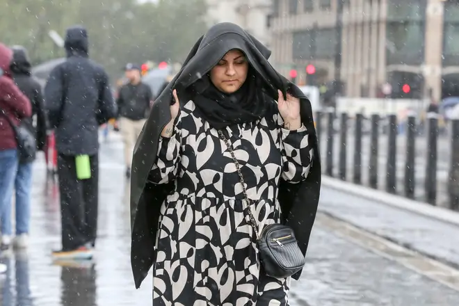
The Met Office has issued yellow wind and rain warnings for areas of the UK - dampening hopes of a return to summery heat after weeks of wet.
The national weather service has said that the south of Wales and south-west England will be lambasted with winds on Saturday 5 August - with Northern Ireland to face significant rain on the same day.
The blustering condition is in stark comparison to last year, which saw extreme heat of 40C - with the mercury staying above 30C for most of July and August.
Read More: August weather forecast: What's the outlook and will the UK get a heatwave?
This year, however, has seen unsettled weather throughout the summer including several days of rain and overcast conditions in the south of England.
According to the Met Office, the UK is likely to see warmer temperatures towards the end of the month, though have dampened hopes of a 32C heatwave.
A new long range forecast reads: "During the second half of August, there is a greater chance of more settled spells developing, with warmer and drier conditions becoming slightly more likely than the unseasonably unsettled weather of July.
"However, unsettled conditions are never too far away and so there will likely still be some spells of rain or showers for many areas from time to time.
"Overall, temperatures look like they will recover to at least average, or a little above, however any prolonged dry or hot spells appear to be unlikely."
According to GFS weather forecasts, parts of the UK could hit 32C on August 12.
Jim Dale, senior meteorologist for British Weather Services, said the UK will finally experience a delayed start to summer thanks to an Azores high pressure system.
"An Azores high is migrating towards and across us and it all starts this time next week if all goes as currently seen," Jim Dale, senior meteorologist for British Weather Services, told the Express.
He continued: "There should be a south to north progress with 32C in south east England by August 12, in my opinion, though, it's still a forecast for now."
"The gradual change is simply down to a change in airstream; cool northerlies at times this week.
"Warm/hot southerlies later next week as the high pressure tracks across us and then out to the east."