Storm Dudley: Danger to life warning as 90mph winds to batter UK within hours
15 February 2022, 16:13 | Updated: 16 February 2022, 10:29
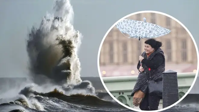

Flood alerts have been issued across swathes of the UK with Storm Dudley set to bring winds of up to 90mph that could pose a "danger to life", the Met Office has warned.
Dudley will hit the northern half of the country on Wednesday afternoon and into Thursday morning, closely followed by Storm Eunice, which will bring powerful winds and the possibility of snow on Friday.
An amber weather warning has been issued for Wednesday evening for strong winds, covering southern Scotland, northern England and part of Northern Ireland.
The warning says there will be "very strong and disruptive" winds which could cause widespread chaos, including a "good chance" of power cuts and disruption to transport services.
READ MORE: Free Covid tests are set to be scrapped for everyone next week, LBC can reveal
READ MORE: 'We don't want war' insists Putin as Nato says there's 'no signs of de-escalation'
"Injuries and danger to life is likely from large waves and beach material being thrown onto coastal roads, sea fronts and properties," the warning adds.
Some Scotrail services have already been cancelled as a precaution.
Yellow warnings are in place for Thursday and Friday covering a wide area.
A number of flood warnings and alerts are currently in place across the country.
Eunice could also bring snowfall on high ground from the Midlands northwards, forecasters have said, with high winds likely to create blizzard conditions in some areas.
Wednesday will be a wet and very windy day for all as #StormDudley approaches from the northwest 🌧️💨
— Met Office (@metoffice) February 15, 2022
Here is the latest #4cast 👇
⚠️ Stay #WeatherAware ⚠️ pic.twitter.com/jnb2VphNFD
National Highways head of road safety Jeremy Phillips said: "We're encouraging drivers to check the latest weather and travel conditions before setting off on journeys and consider if their journey is necessary and can be delayed until conditions improve.
"If you do intend to travel, then plan your journey and take extra care, allowing more time for your journey."
Mr Phillips added: "In high winds, there's a particular risk to lorries, caravans and motorbikes so we'd advise drivers of these vehicles to slow down.
"Drivers of other vehicles should be aware of sudden gusts of wind which can affect handling and braking, and give high-sided vehicles, caravans, and motorbikes plenty of space. In the event of persistent high winds we may need to close bridges to traffic for a period, so please be alert for warnings of closures and follow signed diversion routes."
Dudley is expected to bring wind gusts of up to 80mph-90mph on exposed coasts and hills of Scotland, with 60mph-70mph possible further inland.
Winds are expected to ease through Thursday afternoon and evening.
With severe weather warnings issued, here is some good advice about driving in severe weather, from the experts at @NationalHways and the @TheRAC_UK
— Met Office (@metoffice) February 15, 2022
Stay #WeatherAware⚠️ pic.twitter.com/I22BMumNta
Eunice will track across central areas of the UK on Friday with 60mph-70mph gusts possible inland, perhaps stronger in some places.
The Met Office has said that pin-pointing the strongest winds and worst-affected areas is uncertain at the moment.
RAC Breakdown spokesman Rod Dennis said: "The strength of the wind brought about by Storm Dudley will make driving conditions extremely difficult for drivers in the north of the UK, so we urge people to delay their journeys until the storm passes if at all possible.
"Anyone who does set out should stick to major roads if they can, reduce their speed while driving and have a firm grip of the steering wheel at all times but especially when overtaking high-sided vehicles.
"We also recommend parking away from trees as the storm may well cause some to fall."
Electricity supply firms have also issued warnings following the widespread outages in northern England and Scotland which followed storms earlier this year.


