UK weather: 'Major incident' declared as Storm Christoph brings danger to life warnings
18 January 2021, 19:02 | Updated: 19 January 2021, 00:36


A 'major incident' has been declared in South Yorkshire as the country braces itself for heavy rain and gales during 'Storm Christoph'.
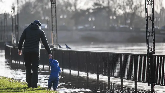
Amber 'danger to life' flood warnings have been issued in some parts of England ahead of treacherous conditions expected this week.
Parts of the UK could see up to 200mm of rain over the first half of the week which, coupled with snow melt, poses a serious risk of flooding in eastern parts.
An amber 'danger to life' flood warning has been issued for Tuesday, Wednesday and Thursday covering a large part of central and northern England.
The warning says there is a "danger to life" due to fast-flowing or deep floodwater and a "good chance some communities cut off by flooded roads".
A major incident has been declared at a South Yorkshire Level in preparation for potential flooding over the next few days.
— Ros Jones (@MayorRos) January 18, 2021
Key risk areas have been inspected over the past 36 hours, sand-bags have been handed out in flood-risk areas & will continue over the next 24 hours. https://t.co/Nwi9UbPUol
Ros Jones, Mayor of Doncaster, said a "major incident" had been declared at a South Yorkshire level in preparation for potential flooding.
In a tweet, Ms Jones said emergency protocols were instigated on Sunday and would run alongside the region's Covid response - with the council and partner agencies monitoring the situation.
She said: "I do not want people to panic, but flooding is possible so please be prepared."
Ms Wright urged people to sign up to the flood warning service to receive updates, adding: "If you receive a flood alert, that's the time to prepare, put medical supplies and insurance documents in a bag that you can take with you.
"If you receive a flood warning that means you are at risk of flooding imminently, so please put your precious possessions upstairs in your house and be ready to turn off your water supply, electricity and gas."
⚠️ ⚠️ Storm Christoph has been named, with heavy rain and flooding likely on Tuesday, Wednesday and Thursday ⚠️ ⚠️#StormChristoph#WeatherAware pic.twitter.com/LHKYniBkfi
— Met Office (@metoffice) January 18, 2021
On how severe the impact of Storm Christoph could be, she said: "We had seen a lot of wet weather, last winter was particularly wet, and we are expecting some big rainfall totals on this weather.
"But the particular issue is that the rain will be falling for some considerable time on very wet ground and that makes the situation very volatile and it's very important that people prepare for that weather."
She said the Environment Agency will deploy pumps, barriers and other equipment, while the opening of flood storage reservoirs is being prepared.
A yellow rain alert is also in place for most of northern England and Wales from Tuesday to Wednesday, before most of the UK falls into the warning on Thursday.
Met Office chief meteorologist Dan Suri said: "Following a cold spell where the main hazard was snow, our focus now turns to notably heavy rain moving across the UK this week.
"Some locations could see over 100mm of rain falling through the course of just a couple of days. with up to 200mm possible over higher ground.
"These amounts of rainfall along with snow melt present a real threat of flooding and people should keep a close eye on flood warnings from the Environment Agency and Natural Resources Wales."
I do not want people to panic, but flooding is possible so please be prepared.
— Ros Jones (@MayorRos) January 18, 2021
Kind regards, Ros
Up to 70mm is expected to fall in that area but in isolated spots, particularly in the northern Peak District and parts of the southern Pennines, 200mm could be possible.
The Environment Agency has issued 11 local flood warnings covering parts of Yorkshire, Derbyshire, Lancashire, Greater Manchester, Merseyside and Cheshire.
There are a further 61 flood alerts, meaning flooding is possible in the area, although the number is expected to increase significantly as the impact of the first heavy rain is felt overnight.
The Environment Agency has urged people living in those areas to prepare for the risk of significant flooding as early as Tuesday morning, as the heavy rain hits already saturated ground.
Defences including temporary barriers and the opening of flood storage reservoirs are being prepared, the Environment Agency said.
Katharine Smith, flood duty manager at the Environment Agency, said: "Environment Agency teams are out on the ground clearing grilles, screens and closing flood barriers.
"We urge people to keep away from swollen rivers and not to drive through flood water - it is often deeper than it looks and just 30cm of flowing water is enough to float your car."
The RAC breakdown service has advised motorists to drive only if absolutely necessary during heavy rain and to avoid floodwater completely.
Here's the #4cast for Tuesday, with heavy and persistent #rain for some as #StormChristoph moves in.
— Met Office (@metoffice) January 18, 2021
⚠️⚠️ Weather warnings ⚠️⚠️have been issued 👉 https://t.co/QwDLMg9c70
Stay #WeatherAware pic.twitter.com/Ojhk8kaWcs
Ben Aldous, the RAC's patrol of the year, said: "The best advice if you encounter water on the road is to turn around and find another route, unless you can be certain that it is shallow enough to drive through.
"At best, deep water could ruin a vehicle or land you with a heavy repair bill, at worst it could mean you're putting your life, and those of the people who might have to come to your aid, in danger."
There will be cooler, calmer conditions towards the later half of the week going into the weekend as Storm Christoph blows its way across the North Sea, leaving strong winds along the east coast.
As of Wednesday afternoon until noon on Thursday, a yellow weather warning for snow and ice is in force stretching from Dundee to Elgin and across to the east coast of Scotland.
It warns there is a small chance of travel disruption, as well as a risk of power cuts and also injury from slips and falls on icy surfaces.
Mr Suri said: "Colder air coming southwards into the weather system brings the risk of further snow on the back edge of this system.
"Temperatures will gradually fall across the UK through the end of the week and into the weekend bringing a return to widespread overnight frosts."