Clive Bull 1am - 4am
14 February 2022, 12:05 | Updated: 14 February 2022, 14:57

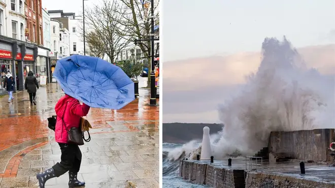
Back-to-back storms are set to batter the UK this week, bringing powerful winds, torrential rain and snow.
Storm Dudley is forecast to bring winds of up to 90mph to the north of England, Scotland and Northern Ireland on Wednesday and Thursday.
This will be followed by Storm Eunice, which could bring winds of up to 80mph to southern parts on Friday.
READ MORE: Biggest London Tube and bus fare hike in a decade announced by Sadiq Khan
READ MORE: 'Extremely dangerous' rapist who attacks women and children flees open prison
The Met Office has issued an amber weather warning for wind from 6pm on Wednesday until Thursday at 9am across a swathe of northern England and southern Scotland, with "significant disruption" expected.
A wider yellow warning, stretching down from the Orkney Islands to parts of Yorkshire and Lancashire, is also in place, running from 3pm on Wednesday until 6pm on Thursday.
⚠️ WEATHER WARNINGS⚠️
— Traffic Scotland (@trafficscotland) February 14, 2022
The @metoffice have issued a YELLOW and AMBER weather warning for 🌬️WIND 🌬️
YELLOW: Wednesday(16/02) 15:00- Thursday(17/02)-18:00
AMBER: Wednesday(16/02) 18:00- Thursday(17/02)- 09:00
Full information can be found here 👉 https://t.co/H1r2hhIf7A pic.twitter.com/1PAcZiToJC
As part of the yellow warning, the forecaster said there was the potential of inland gusts of up to between 60mph and 70mph, with exposed coasts and hills seeing speeds reaching 90mph.
Strong winds will cross western Scotland and Northern Ireland on Wednesday evening, pushing eastward to northern England overnight and through Thursday morning.
A second yellow warning for wind is now in place from midnight on Thursday night until 9pm on Friday across all of England, Wales and Northern Ireland, and southern Scotland, as Storm Eustice arrives.
Winds of 60mph-70mph gusts are possible inland, perhaps stronger in some places, though the strongest winds and worst-affected areas are currently uncertain, the Met Office said.
This system is also expected to bring some heavy rain and there is a potential for some significant snowfall over hills in the Midlands and further north.
A Met Office spokesman said: "With regard to Storm Dudley, snow will mostly be on high ground, with the highest accumulations in the Grampians.
"Lower down, any snow is likely to be short-lived but when it is coming down it is likely to be blizzard conditions."
#TwoStorms have been named
— Met Office (@metoffice) February 14, 2022
Fom Wednesday afternoon #StormDudley is forecast to bring strong winds to northern parts of the UK
Then on Friday, #StormEunice will bring strong winds to more southern areas and snow to northern areas
Warnings are in force ⚠️
Stay #Weatheraware pic.twitter.com/PUGpBz3hGw
Met Office meteorologist Tom Morgan warned that "this whole week is going to see quite a disturbed weather pattern developing across the UK".
Mr Morgan said: "Western parts of Scotland look like bearing the brunt of the strongest winds, where we could see gusts of 80mph to 90mph on Wednesday night and Thursday morning.
"That's strong enough to bring some quite widespread disruption, and it's an area of the country that's seen several named storms this winter season already."
He added: "The southern parts of England and Wales will see their turn. It looks very, very windy in the south at this stage for Friday.
"There could be some quite widespread travel disruption in parts of the UK through this week."
He said that everywhere in the UK "will see some very strong winds at times".
"It's Scotland and the North's turn on Wednesday and into Thursday, and then it's probably going to be the southern parts of England and Wales that will see the very strongest winds on Friday," he said.