
Shopping centre in East Sussex evacuated due to flooding as Britain hit by more heavy rain
28 October 2023, 16:57
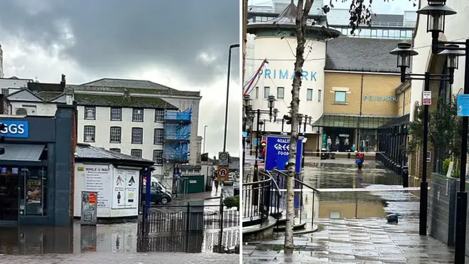


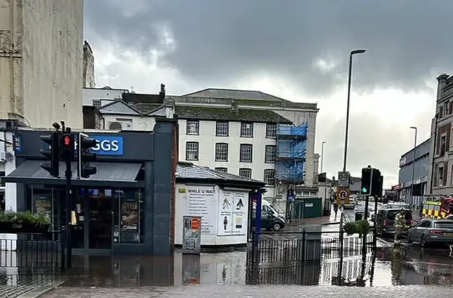
A shopping centre in East Sussex has been evacuated due to flash flooding, with strong winds and heavy rain continuing to batter parts of the UK.
Listen to this article
Loading audio...
More than 100 flood alerts have been issued across the country, just a week after Britain was battered by Storm Babet.
East Sussex Fire and Rescue Service said they were assisting with the situation at Priory Meadow Shopping Centre, where social media footage showed deep floodwater had come inside through the entrance on Station Road.
The service also urged people to move any cars that may be parked in the town centre.
A spokesperson for the service said there are no formal plans to evacuate homes for now.
Trains between Hastings or Eastbourne and Ashford International are running at reduced speed due to a fault with the signalling system, Southern Rail posted on X, formerly Twitter.
The train operator said they were informed of lightning damaging the system in the area.
It comes amid warnings other parts of the UK will continue to be at risk of flash flooding over the rest of the weekend.
Areas in London and the south of England, the Highlands and north east of Scotland and Northern Ireland are all set to be lashed over the next few days, the Met Office has said.
The worst affected regions could see 70mph gusts or up to nearly four inches of rain, leading to possible flooding, travel delays and power cuts.
Read More: Exact date temperatures to 'plunge to -6C in polar blast' as Met Office issues fresh forecast
Met Office forecaster Dan Stroud said: "On Saturday we've got frequent showers across the south and west which will move across Wales and into the south-east during the morning, before a more general area of cloud and rain moves up, bringing heavy rain and strong winds.
"That will move northern eastwards during the course of Saturday and into Sunday, behind it showers which could be locally heavy and thundery and particularly squally.
"We do have a yellow rain warning covering London and the south-east until the end of Sunday, talking about fairly heavy rain, 15 to 30mm, some spots could see highs of 50 to 70mm with some strong, gusty winds, there could be some localised impacts.
"The band of cloud and rain will continue moving northwards during Sunday, especially focused in eastern Scotland, which is already rather sensitive following the high rainfall from Storm Babet, so more unwelcome rain for that patch of the world and we have a yellow rain warning in place there today and tomorrow, talking about 50 to 80mm of rain accompanied by strong, gusty winds of 50 to 70mph.
"On it's own the rainfall totals are not that high but given the fact we've had all that rain from Storm Babet it doesn't take much for there to be localised impacts because the ground is already saturated."

On Saturday, some rail services in Scotland have been suspended, with customers advised to check their journey before travelling.
The latest Scottish Flood Forecast said "significant flooding impacts" are likely in the north east on Friday and Saturday due to torrential downpours.


