
Met Office warns of 10 hours of thunderstorms after Brits bask in mini-heatwave
7 September 2021, 11:53 | Updated: 8 September 2021, 11:02
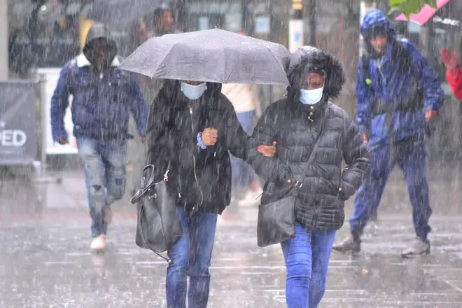


The UK's mini-heatwave is set to come to an end in the next few days as the Met Office is warning of 10 hours of thunderstorms.
Storms are set to batter parts of the UK on Wednesday and Thursday, following a short period of high temperatures.
⚠️ Yellow weather warning issued ⚠️
— Met Office (@metoffice) September 7, 2021
Heavy showers 🌦️ and thunderstorms ⛈️
Thursday 1100-2000
Latest info 👉 https://t.co/QwDLMfRBfs
Stay #WeatherAware pic.twitter.com/2aZWpBbUjU
The first yellow weather warning is issued for south west England and Wales on Wednesday.
It warns that homes and businesses could flood quickly.
It also says there is a chance of difficult driving conditions, transport disruption as a result of flooding or lightning strikes, and a small chance of power cuts and communities being "cut off" by flooded roads.
The warning is in place from 11am, and is due to end at 9pm.
Read more: 'Where's the £350m a week for the NHS we were promised when we left the EU?'
Read more: Sajid Javid brands highest tax hike since the war a 'very Conservative move'
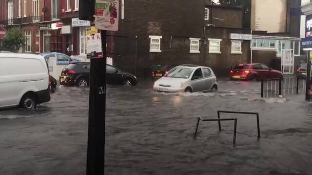
Flash floods across London cause travel chaos
The second weather warning covers much central England and Wales, as well as Northern Ireland.
It also warns of rapid flooding and transport disruption.
It is in place on Thursday between 11am and 8pm.
The warnings follow high temperatures on Monday and Tuesday, where temperatures soared to the late twenties, and were even set to hit 30C on Tuesday - hotter than Barcelona.
Read more: Indian summer: UK to be hotter than Barcelona as temperatures soar to 30C
Read more: France bans sale of inflatable boats from Channel ports in bid to stop migrant crossings
The Met Office said some areas were edging close to recording an official heatwave this week as pupils head back to school.
More widely across England and Wales, conditions will be in the mid-to-high 20s, while Scotland and Northern Ireland could see temperatures around 24C to 25C.
A location meets the UK heatwave threshold when it records a period of at least three consecutive days of daily maximum temperature levels meeting or exceeding thresholds which vary across the country.
Mr Dewhurst said central and eastern parts of England were "most likely" to record an official heatwave across Monday to Wednesday, but will only "just about make it".
"We often get a warmer spell particularly early on in September," Mr Dewhurst said, adding: "August was particularly cool... and cloudy, so this spell is the warmest spell of weather since July for the UK."


