
Storm Evert to bring 'unseasonably strong winds and heavy rain' across south of UK
29 July 2021, 11:16 | Updated: 29 July 2021, 15:25
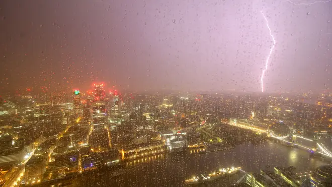


Strong winds and heavy rain are set to batter parts of the UK this evening with the arrival of Storm Evert, the Met Office has said.
Storm Evert is expected to impact mostly southern areas, starting late on Thursday and going into Friday.
An amber warning for wind was issued by the Met Office for the southwest of England, in preparation for Storm Evert.
Other areas in the south of the country - mostly along the coast - have also received a yellow warning for wind on Friday.
Met Office principal operational meteorologist Dan Suri said: "Storm Evert will bring some high winds, particularly along the northern coast of the South West, but there will be gusty winds more widely in southern areas, which brings the potential for some impacts, especially for those that might be travelling or camping in the weather.
"Storm Evert will move eastwards across southern UK during Friday daytime, clearing into the North Sea during Friday evening.
"As well as the high winds, there will also be some heavy rain before it leaves our shores, with up to 40mm possible over parts of Wales and the South West and the potential for 40 or 50mm rain in a short period of time from heavy, possibly thundery, showers over parts of eastern and central England on Friday afternoon."
Read more: Flash flooding sparks disruption across London amid torrential downpours
#StormEvert has been named and is forecast to bring unseasonably strong winds and heavy rain to southern parts of the UK later today and into Friday #weatheraware pic.twitter.com/O75aWu2iLd
— Met Office (@metoffice) July 29, 2021
Gusts of 55 to 65 mph are expected in the coastal areas, with the chance of them reaching 75 mph in the most exposed coastal spots in Cornwall.
The Met Office said that the storm could subsequently cause damage to infrastructure and lead to travel disruption.
In their State Of The UK Climate 2020 report, the Met Office previously warned that the UK could see temperatures as high a 40C in the future.
Climate change led to 2020 being the third warmest, fifth wettest and eighth sunniest year on record.
Read more: British summers could regularly hit 40C due to climate change, Met Office warns
#StormEvert will bring a spell of unseasonably strong winds to southern parts of the UK during the next 24 hours
— Met Office (@metoffice) July 29, 2021
Amber and yellow wind warnings have been issued with the risk of disruption likely
Latest info 👉 https://t.co/QwDLMfRBfs
Stay #weatheraware⚠️ pic.twitter.com/SbiYpgKBP5
Heavy rain, lightning and hail "the size of garden peas" have caused a lot of disruption across England throughout recent weeks.
The downpours left parts of London under water, while the whole of the UK saw almost a month's worth of rain in a single day.
Tube stations were forced to close as well as roads being flooded across the capital.
Read more: Sadiq Khan: London flash floods shows climate change danger is 'closer to home'
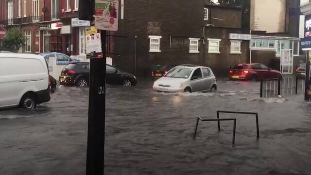
Flash floods across London cause travel chaos
It comes as the UK has seen a vast change in weather in recent months, from heatwaves to flash flooding.
As a result, more than £860 million will be invested in flood prevention schemes across the UK over the next year, the government recently announced.
The intention is to better protect 336,000 properties and reduce the national flood risk by up to 11 per cent by 2027.
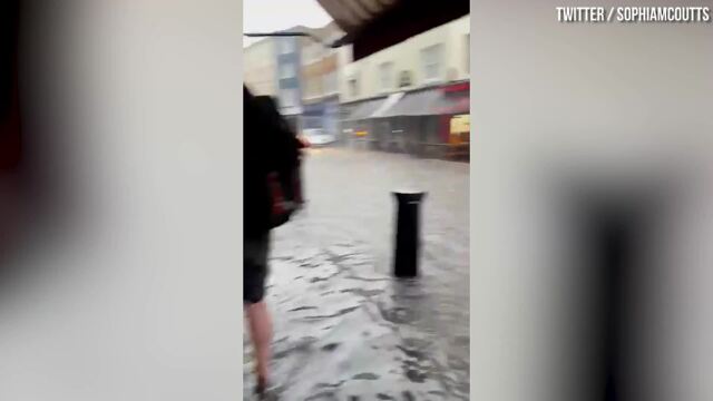
Portobello Road hit by flash flooding
There has also been severe flooding in European countries including Belgium, Germany and Italy, leaving hundreds dead.
Environment Secretary George Eustice said: "The tragic recent events in Germany and Belgium serve as a sobering reminder of how devastating flooding can be.
"It's important we take action right across the system.
"Our comprehensive plan will achieve this by tightening planning procedures, helping more people access insurance and making homes more resilient to the effects of flooding."


