
Thousands without power and planes unable to land as Storm Isha puts UK on 'tornado watch' with 90mph winds
21 January 2024, 21:44 | Updated: 21 January 2024, 21:54
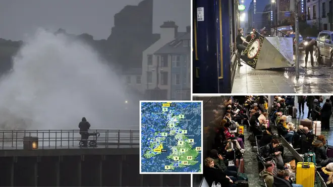


Thousands are left without power and planes have been unable to land as 90mph winds hit the UK as the Met Office warned of a possible chance of a tornado on Sunday night.
Listen to this article
Loading audio...
The UK entered a 12-hour Met Office amber alert at 6pm as high "destructive" winds hit the country posing a possible "danger to life".
People have been told to stay inside and not to make unnecessary journeys as the Met Office warned there was a slim chance a tornado could hit western parts of the UK.
Research organisation Torro said Ireland, Northern Ireland, parts of Scotland and northern England were "tornado watch" zones. The designation means a "strong tornado" is possible in those regions.
"There is a potential that we could see the odd isolated tornado largely tied in with the squally cold front mainly in western parts of the UK on Sunday evening," Met Office forecaster Marco Petagna told the PA news agency.
"They can cause some significant damage but often on a very localised scale, they often don't tend to last very long."
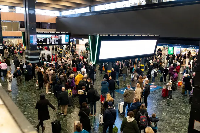
Air passengers have also been thrown into chaos as planes were unable to land safely amid the chaotic winds.
Rail, sea and air travellers were all hit with disruption, with closures, cancellations and delays expected across a number of services.
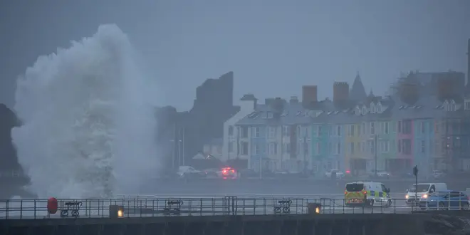
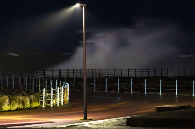
Damage to homes and buildings, falling trees, power cuts, flying debris, large waves and even some flooding in places should also be expected, forecasters have warned.
The Met Office said 90mph winds hit Capel Curig in north Wales during the afternoon. Meanwhile, 76mph gusts were recorded in Loftus, North Yorkshire and 75mph winds blasted Brizlee Wood, near Alnwick in Northumberland, and Emley in Huddersfield.
Agencies across Cumbria have declared themselves on standby for a major incident, while elsewhere a person was hit by debris in Belfast.
Met Office meteorologist Tom Morgan said: "We're expecting widespread gales to affect the UK, amber warnings are in place for large parts of the country.
"There's the potential for danger-to-life and damaging winds potentially leading to some power cuts in places, some large waves around coastal regions could bring some debris onto roads and trees could come down."
He added: "We have a wind warning in place across the whole of the UK, it's pretty unusual for the whole of the country to be under a blanket wind warning."
The Met Office has said "everybody" will be affected by the storm.

Read More: Arctic weather brings misery to parts of US as death toll rises to 55
Read More: Brutally cold weather expected to hit south and north-east US
Further adding to the torrent of weather, nearly four inches of rain could fall over a few hours in some regions and cause localised flooding, with 23 flood warnings already in place across England.
Network Rail said 50mph speed restrictions have been imposed across most routes to keep passengers and trains safe from falling trees and debris blown onto tracks, with disruption likely to continue into Monday morning.
Scotland's railway operator already cancelled all of its services after 7pm and there will also be no Monday morning rush-hour services.
One train struck a tree at Crosshill, near Glasgow, while Network Rail teams responded to reports of a fallen tree on the overhead wires at Gartcosh, near Cumbernauld.
A number of rail services across the country warned against travel, while air traffic control restrictions were in place, leading to some flight cancellations.
National Air Traffic Services (Nats) told PA: "Due to adverse weather conditions across the UK, temporary air traffic restrictions are in place. Restrictions of this sort are only every applied to maintain safety.
"Our teams are working closely with airports and airlines to minimise disruption. Passengers should check the status of their flight with their airline."
British Airways said: "Like other airlines, we have had to make schedule adjustments due to the adverse weather conditions across the UK and Europe caused by Storm Isha.
"We've apologised to our customers for the disruption to their travel plans and our teams are working hard to get them on their way as quickly as possible."
Ferry company Wightlink also warned of potential disruption, while the RAC warned drivers to lower their speeds and even consider delaying journeys.
Storm Isha is the ninth named storm to hit the UK since the season began in September.
Each storm is named when it poses a risk to people and they are given names beginning with consecutive letters of the alphabet.
The record number of named storms in one year is when the Met Office began the practice in 2015/16, with Storm Katie being the 11th and final storm of the season.
If there are three more named storms between next week and August, this year will mark a new record.
Cold Arctic air pushing south into North America is making the jet stream more active, the Met Office said, and because it flows from west to east, it is bringing stormier weather to the UK.


