Met Office snow maps reveal exact dates and locations Arctic blast will hit as temperatures plummet to -11C
11 January 2024, 11:45


The Met Office has revealed the exact dates and locations where snow is set to fall over the coming days, with temperatures expected to plummet to -11C.
Listen to this article
Loading audio...
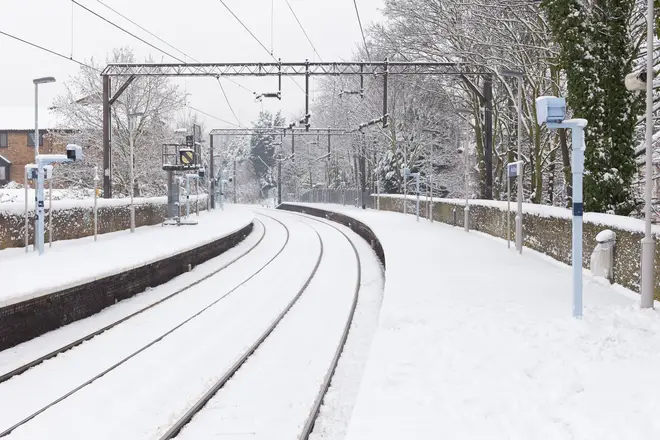
Parts of the UK were hit by snow earlier in the week, including London and Kent, but it was largely confined to southern England and failed to settle beyond 24 hours.
While temperatures are expected to return to more average levels by the end of tomorrow, a fresh batch of cold air will move in from Saturday.
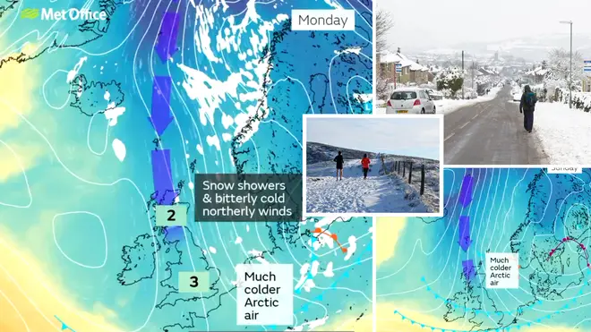
"Much colder arctic air" will then move in on Saturday evening into Sunday morning, with Scotland and the north of England to be affected the most.
Heard that it's turning colder with snow possible next week?
— Met Office (@metoffice) January 10, 2024
High pressure will keep it settled for the next few days but temperatures will plummet later in the weekend as Arctic air surges southwards bringing snow showers in places📉 pic.twitter.com/LKrnM3D8sx
Temperatures are expected to drop well below -0C in some areas, with lows of -11C in Scotland, though most of the UK will be hit by the Arctic blast.
Following the Arctic blast, the Met Office says Brits will be in for "snow showers and bitterly cold northern winds".
Read More: Met Office warns of more snow as second Arctic blast set to bring freezing temperatures
January forecast
It has been cold for millions of Brits this week, with the cold snap seemingly here to stay.
According to the Met Office's long-range forecast, which runs from January 15 to 24, the continued "unsettled weather" is likely to continue.
It reads: "There is risk of unsettled weather pushing in from the south through this period, which could lead to a band of snow and sleet where it meets the colder air across the country.
"Confidence is low with regards the timing of the arrival of any such disturbance, but there is an increasing risk of something potentially disruptive at some point in this period.
"Widespread frosts continue to be a feature by night, with a risk of ice in places."