
Brits braced for 250-mile wall of snow as weather alerts issued and drivers told to take extra care on ‘ice rink Monday’
4 December 2023, 09:49 | Updated: 4 December 2023, 12:59
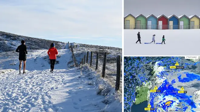


Brits could face a 250-mile snow front with new weather warnings issued for today.
Listen to this article
Loading audio...
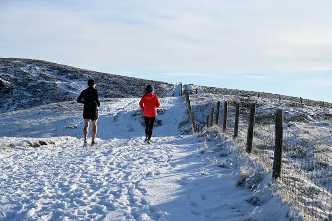
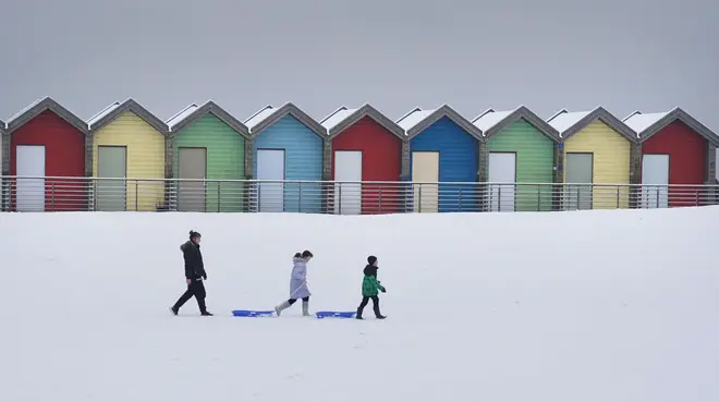
Snow and ice warnings are in place until midday for Scotland, northern England and parts of North Wales with up to 10cm of snow forecast in some places.
Parts of the Peak District and North Wales could get up to 15cm of snow.
Read More: Exact date snow will end as temperatures to hit 13C after cold snap
Drivers have been warned they face "very treacherous icy conditions" in parts of the UK on Monday after another night of sub-zero temperatures.
Overnight temperatures, which dipped to around or below freezing in many of the affected areas, were expected to cause icy patches on untreated surfaces due to thawed snow refreezing.
RAC Breakdown spokesperson Simon Williams said northern parts of the country could be facing an "ice rink Monday as snow refreezes overnight".
He said: "We're expecting some very treacherous icy conditions in northern parts, so those who have to drive should exercise great caution. If it's possible to delay or even abandon journeys that may well be the best option.
"Those who decide to drive should leave extra space behind the vehicle in front, reduce their speeds to give plenty of time to stop.
Read more: Shocking moment robbers rip £30,000 Rolex from man's wrist in London street
🌧️ Rain, sleet and hill snow across England and Wales on Monday could bring some disruption to morning travel
— Met Office (@metoffice) December 3, 2023
🌦️ A brighter but frosty start in Northern Ireland and Scotland with scattered showers leading to icy stretches
⚠️ Stay #WeatherAware pic.twitter.com/zWxGXWjus1
"Before setting out, it's important to allow more time to de-ice and de-mist vehicles thoroughly."
ScotRail advised passengers to check their journey before leaving home.
The Met Office has also issued a yellow warning for heavy rain creating disruption to travel across parts of southern England, south east Wales and into the Midlands which will last until 6pm.
The warning was extended on Monday west to include more of Devon and Somerset.
Electricity North West said it was making hot food available at Greenodd Service Station in Ulverston on Monday morning for customers who remained without power.
On Sunday evening, they said 1,500 properties in Cumbria remained without electricity after power cuts followed heavy snow in the county.
The electricity network operator said it had restored power to 7,500 homes, adding that "access continues to be a major issue and even specialist 4x4 vehicles cannot reach all sites" with "equipment for repairs being carried on foot in some locations".
It added that Cumbria's power network had been severely impacted by the snow with more than 35 separate damages to the network reported, including "severe damage to miles of overhead lines".
Cumberland Council said nearly 40 schools would remain closed on Monday due to the conditions.
The UK Health Security Agency and the Met Office have issued amber cold health alerts in five regions, the East Midlands, West Midlands, North West, North East and Yorkshire and the Humber, until December 5, meaning "cold weather impacts are likely to be felt across the whole health service for an extended period of time".
This week, we've been discussing the dangers on our roads. But there are ways to help yourself, and others around you...
— The RAC (@TheRAC_UK) December 1, 2023
Here are some quick tips for staying safe. 🚗#RACReportonMotoring2023 pic.twitter.com/PYmvzBf0Mp
England and Wales was expected to be largely cloudy outside the warning areas on Monday with outbreaks of rain, some of them turning heavy.
Overnight snow was predicted to be confined largely to the north east and on hills with frost and ice in the north and north west.
The Met Office said rain and hill snow will gradually ease across England and Wales on Tuesday with brighter spells developing. It will be sunnier but cold elsewhere with a few wintry showers in the north east. Lighter winds for most.
After frost and fog clears for bright spells on Wednesday, wet and windy weather is expected to arrive from the south west, pushing north and east into Thursday and Friday, with some initial hill snow.


