
Map shows exact date and time ‘340-mile’ snow blast to hit UK with freezing temperatures forecast across country
2 April 2024, 11:59 | Updated: 2 April 2024, 12:02


A new weather map has revealed the exact date and time the UK is set to face a ‘340-mile’ snow bomb.
Listen to this article
Loading audio...
The snow event is expected to arrive in the UK on Friday 5 April, which may come as a blow to those hoping for the arrival of Spring sunshine.
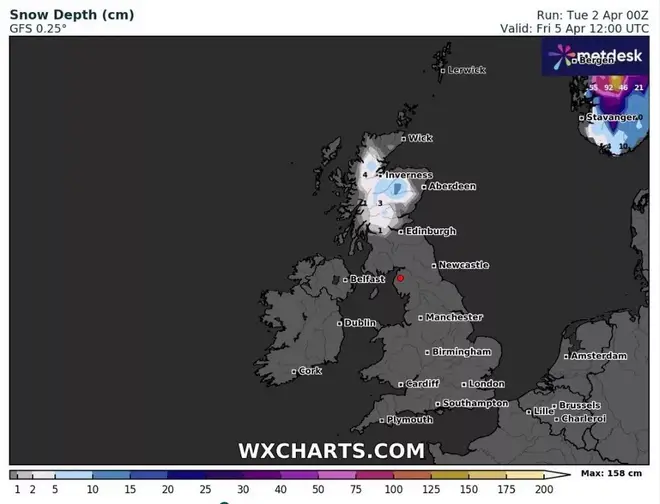
A weather map from WXCharts, which uses Met Desk data, show the snow is due to arrive first in Inverness in the Scottish highlands around 9am before it gets heavier and starts to move further south.
Temperatures are expected to plummet to -1C across parts of central and northern Scotland, meanwhile, they could hit 0C in the Yorkshire Dales.
James Madden, from Exacta Weather, said: “This will also significantly heighten the snow risk for parts of northern/northeast England and Cumbria in addition to Scotland from around midweek, and wintry weather could now also be seen in parts as far as central, eastern and southern England as rain turns to sleet and snow in some of these regions throughout Wednesday and into Thursday.
“Additionally, there is also the ever-increasing risk of another snow event towards the end of the working week and into next weekend, impacting regions from at least central and northern England upwards into parts of Scotland and possibly more southern areas - not definitive, or certain, for these parts as of yet for this snow event.”
Read more: Exact date snow bomb to hit UK in April before temperatures soar in Spring sunshine
What does the Met Office say?
The Met Office forecast for Thursday to Saturday reads: “Spells of rain and showers continuing over the coming days and becoming increasingly windy. Rather mild in the south and turning increasingly mild in the north after a chilly start.”
Between 6 April and 15 April, the long-range forecast reads: “The ongoing unsettled spell of weather is likely to continue into this period with little sign of any dramatic change.
“Areas of rain are likely to become more widespread across the UK through the first few days of the period, with western hills likely to see the largest rainfall totals. Probably widely windy, with a risk of spells of gales, or even severe gales at first in the exposed west and south.
“Over the following week, there may be trend towards slightly longer spells of more settled weather from the south-east, pushing the focus of most frequent rain towards the northwest. Above average temperatures most likely, albeit often tempered by cloud, rain and occasional strong winds.”
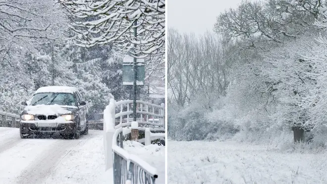
It comes after parts of the UK were hit by blankets of snow last week amid Storm Nelson.
Snow fell across a wide area of the county, including Dartmoor National Park in south Devon, and Exmoor in north Devon.


