
Summer holiday washout: Torrential downpours set to batter UK as month's worth of rain to fall in 48 hours
22 July 2023, 12:23 | Updated: 22 July 2023, 12:32
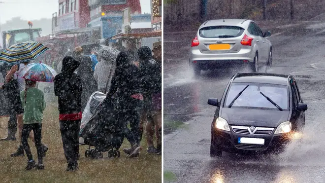


Torrential rain is set to sweep the UK this weekend, marking the beginning of a summer holiday washout.
Listen to this article
Loading audio...
The Met Office said some areas will see "heavy and persistent" rain on Saturday, especially over high ground in the west.
It also issued an urgent warning for Sunday across parts of northern England and Wales, predicting a month's worth of rain would be on the way over the weekend.
The entire first two weeks of the holidays are set to be a washout across the UK, but there are signals that indicate during the second week of August the weather could start to become more settled.
It comes as millions of families are expected to take to the roads over the weekend for a day trip or holiday, according to the RAC.
The UK is seeing poor weather due to the position of the jet stream - which is also pushing high pressure to the south where parts of Europe are seeing a heatwave.
Read more: When will warmer weather return to the UK? Met Office makes new forecast for August
⚠️ Yellow weather warning issued ⚠️
— Met Office (@metoffice) July 22, 2023
Rain across northern England and Wales
Sunday 0000 – 2359
Latest info 👉 https://t.co/QwDLMfRBfs
Stay #WeatherAware⚠️ pic.twitter.com/UplEbJ6xYx
Rachel Ayers, meteorologist at the Met Office, said: "At the moment it's divided, we sit on the cold side of the jet to the north of it, we've got low pressure coming.
"It can stay like this for quite a while as it has been for the last few weeks.
"It's hard to say when it will all break down, it's not looking like anything will soon.
"The heatwave is starting to ease a little in parts of Europe, but now the focus is moving to Italy and Greece away from Spain."
🌧️ A dull and wet afternoon to come for much of the UK
— Met Office (@metoffice) July 22, 2023
🌦️ Drier across Scotland with showers and brighter spells pic.twitter.com/b44f4r5uIZ
She added: "Looking at a longer range, it will be cool and changeable, into the second week of August it could be a little more settled.
"But it doesn't mean we're not going to see any settled interludes in the meantime, on Tuesday we've got a nudge of high pressure which means showers will be less heavy and more isolated, so it'll bring a more settled day.
"The overall picture for the next couple of weeks is mostly damp and no prolonged spells of settled weather or above average temperatures."
Want to know what the weather has in store this afternoon?
— Met Office (@metoffice) July 22, 2023
Here is Rachel with all the details 👇 pic.twitter.com/h9CqJrwjN1
Despite colder weather conditions sticking around in the UK, the rest of Europe is still facing the worst of the Charon heatwave.
Greece is bracing for more intense heat over the weekend, with highs of 45C on the cards.
People have been advised to stay at home and tourist sites remain shut as wildfires continue to take over.
It could turn into Greece's hottest July weekend in 50 years, one of the country's top meteorologists said.


