
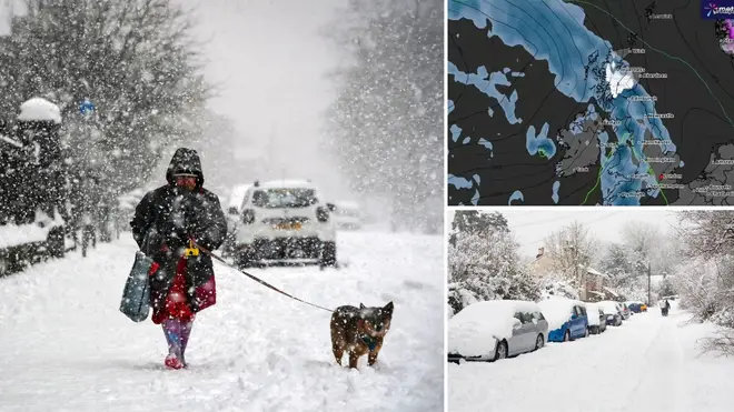
Exact time ‘double snow bomb’ due to hit UK bringing freezing temperatures of -2C in return of wintry weather
14 March 2024, 12:00


New weather maps have revealed the exact time a ‘double snow bomb’ is expected to hit the UK.
Listen to this article
Loading audio...
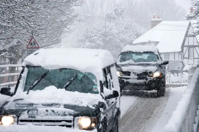
Wintry conditions are set to make a sharp comeback in the UK tomorrow with temperatures as low as -2C across the country.
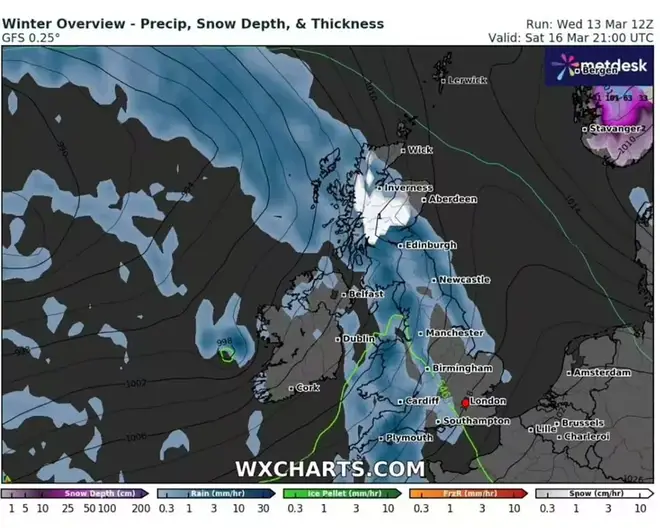
Weather maps from WXCharts show that the freezing conditions could arrive as early as tomorrow.
Around 2cm of snowfall an hour has been forecast in some areas in Scotland, including Inverness and Fort William.
The snowfall is set to continue into Saturday, lasting until about 9pm.
Read more: Arctic blast sweeps UK bringing -7C deep freeze as snow maps show worst hit areas
Read more: Met Office reveals exact date snow to hit this month in late winter blast
Moving further down south, parts of England are forecast for a washout weekend with heavy rainfall predicted in parts.
London can expect temperatures of 4-5C on Saturday morning, potentially climbing to 10C by the afternoon.
Jo Farrow, a weather expert from Netweather, added: "The occlusion from the second low will pull southwards on Friday, away from Ireland and slowly down Britain.
“This allows colder air to flow down from the north ready for a clear Friday night. Next, a large Atlantic low pressure begins to edge towards the UK at the weekend.
"This will bring more widespread rain, heading northeastwards through Saturday along with milder air. It clears to a cooler Sunday with bright spells but plenty of showers from the west."
What does the Met Office say?
The Met currently has 21 flood warnings in place across the country, meaning flooding is likely, alongside 133 flood alerts, meaning flooding is possible.
In its forecast for the weekend, it says Brits can expect cooler temperatures on Saturday, with frost expected in the North.
In a long-range forecast from 18 March - 27 March, the Met says: “Into the new week a continuation of the changeable but generally mild conditions looks likely. Rain heaviest in western, especially northwestern areas while parts of the south and southeast are likely to see longer, drier interludes.
“Winds generally light to moderate in the south and east, with stronger winds affecting north-western areas at times, although at this time nothing exceptional is expected. Into the latter part of next week and beyond we see a trend for temperatures to fall back closer to average across the UK.
“There is a small chance of more notable colder conditions developing, most probable across the north of the UK, but at this stage any confidence in this remains low.”


