
Return of the big freeze: Maps show exact date up to eight inches of snow to hit as Britain braces for Arctic blast
6 February 2024, 10:42
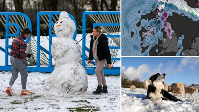


Brits are to face another cold snap this week, with some areas of the country being enveloped in snow.
Listen to this article
Loading audio...
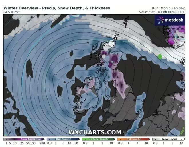
New maps by WXCharts have revealed a swirling snow bomb is set to ring around the country before the blizzard hits Britain.
On Monday, the Met Office announced that the country may face snow during February’s second week.
Scotland has been hit with cold air, which will move further south.
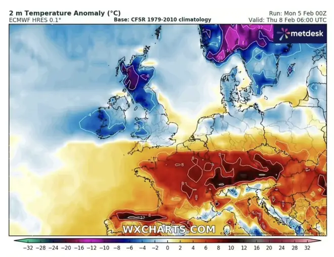
New maps also show that temperatures will plummet to below-freezing for many areas of the UK on February 8.
The temperature could dip to a freezing -8C in some parts of Scotland.
Read more: Met Office issues major weather warning as 250-mile snow wall set to sweep UK
Read more: Exact date Brits will be blasted with three seasons in a week as cold, rain and sun all expected just days apart
The north and northwest of England will experience only slightly warmer temperatures of -6C, but the south and southeast will be above the zero-degree mark.
Highs of 2C and 4C will be experienced in places such as Falmouth, Turo and Penzance.
Two days later, Scotland, Ireland, Northern Ireland and parts of England could experience snow.
The Highlands and Pennines may even experience snow of 10cm to 25cm.
Meanwhile, the more southern areas of the UK will instead encounter rain.
These warnings come after the Met Office announced that the UK will experience wet and cold weather.
Deputy Chief Meteorologist for the Met Office, Chris Almond said: 'While the early part of this week will see some rain, at times heavy, gradually sinking southwards, there’s an increased signal for wintry hazards as we move through the week as cold air from the north moves over the UK.
"It’s from Thursday that the snow risk becomes more potentially impactful, as mild air attempts to move back in from the south, bumping into the cold air and increasing the chance of snow developing on the leading edge.
"While there are still lots of details to work out, the initial snow risk looks highest in northern England and Wales from Thursday.
“One to 2cm is possible to low levels, with 10-20cm possible over the highest ground within the warning area. This snow will likely gradually transition to sleet and rain later on from the south," Mr Almond concluded.
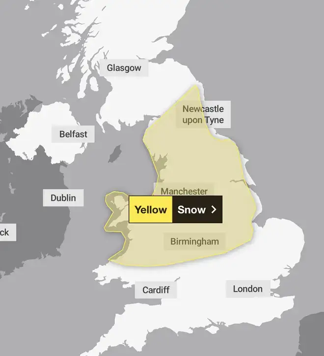
Weather warnings have been issued for England, Wales and Scotland and on Thursday and Friday there are yellow weather warnings for snow for Birmingham, Liverpool, Manchester, Leeds, and York.


